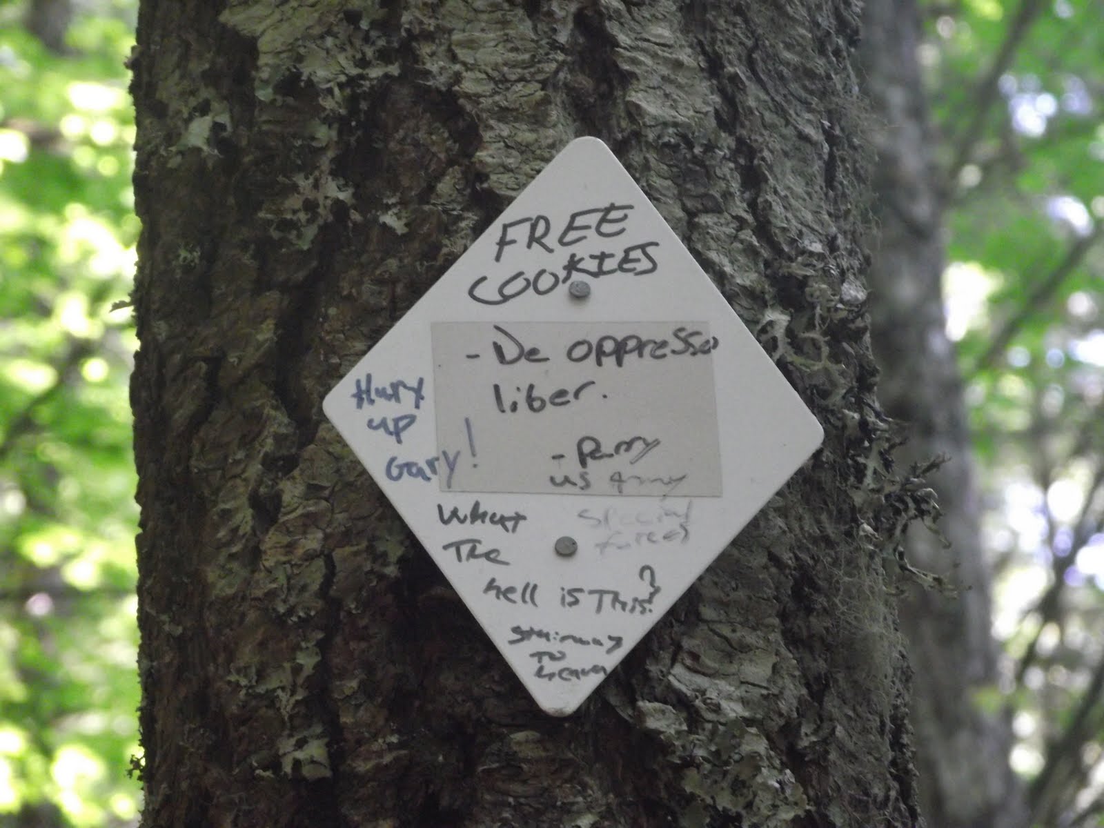
* Reminder: Click on any photo to see it larger!
Early this week, Collin and I decided to do one last camping trip for the summer. We were happy to be able to get in 2 camping trips this summer, as last summer we didn't get to go at all (too busy with weddings and job searches) and the previous summer we went once. My goal this year is that I still make time to do plenty of hiking so I can enjoy the school year more, rather than looking forward to summer just to be outdoors!
We went to Hoodsport, which is on the SE corner of Olympic Nat'l. Park. We had intentions of camping at Staircase Campground, and already had our eyes on Site #7 (pictures were available online) because a river went right by the site. I love any campsite with a creek or river running by it. It offers more entertainment during the day and a peaceful sound at night. We drove by Lake Cushman, which was very blue and beautiful, on our way to Staircase. Finally, after a long drive on a dirt road, we got to the Nat'l Park entrance, where a sign read "CAMPGROUND FULL." Thus, we turned around, avoided the $15 park entrance fee, and started heading back to Big Creek Campground, which we saw miles back. We got to Big Creek and after a couple drives through the grounds, realized we had it COMPLETELY to ourselves. We could pick any site we wanted! We chose a site that had a few really cool trees right in the middle of the site and a loop drive for Biscuit (my car). When we got there, we noticed a number of HUGE ravens flying overhead, making quite the commotion. I'm somewhat creeped out by ravens but also fascinated, so we stayed. Here are a few photos taken at our site:
 |
| Thanks for the tent Andy! |
 |
| I spotted this little fabric bird in a tree and thought it was adorable! |
 |
| Plenty of huckleberries around the site. |
 |
| Who needs a campstove? Previously cooked turkey burgers :) |
 |
| Played with our light-up frisbee at night! |
After we set up our tent (which was given to us last year for our wedding by my awesome Uncle Andy!) and unloaded our fire wood, we decided to take a trek around the campground and find the Big Creek. The following photos were taken at the creek by the campground:
 |
| Collin is happiest when he's running around on logs and rocks. |
 |
| Wish I could flip this photo... |
 |
| Collin's a natural when it comes to balancing on logs. Me, on the oth | | er hand... |
|
|
 |
| Hurry and take the photo so I can come back down! |
 |
| Relaxing in the sun while Collin continues to hop around. |
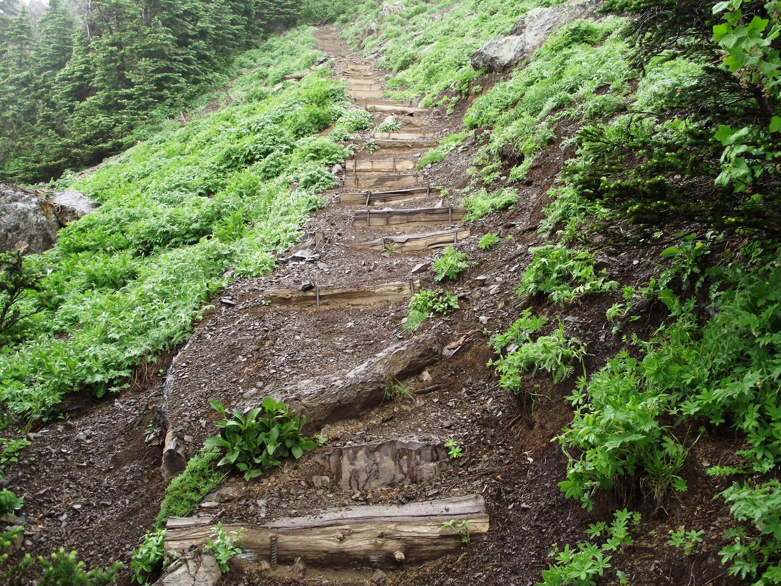
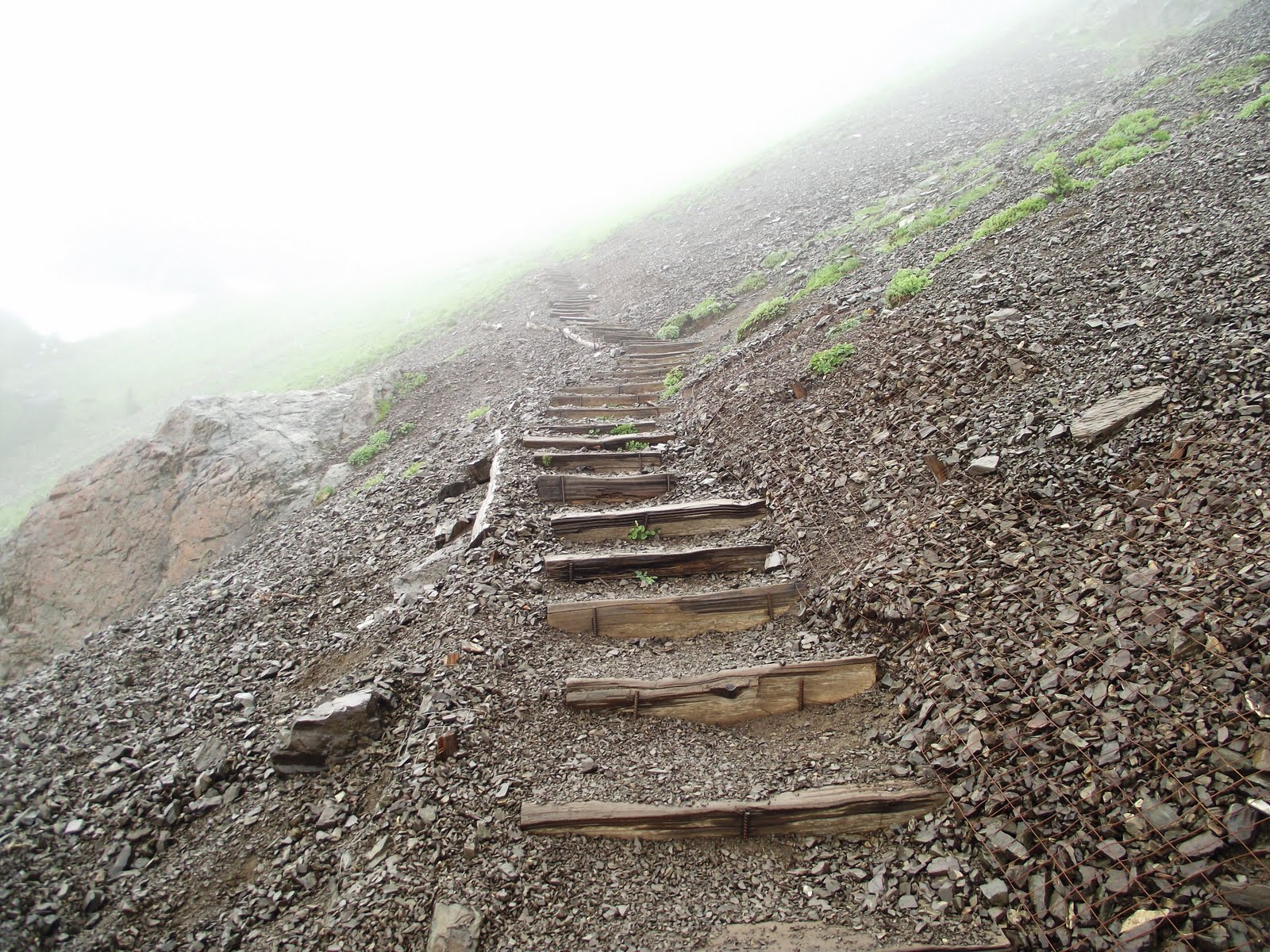
The next day, we left the campground and headed for our Mount Ellinor climb. The climb is 6.2 miles roundtrip (up to the summit and back) and there's a 3,200 ft. elevation gain. I was able to test out my new hiking boots and wool socks, which worked great! I also banged up my legs pretty bad (you'll understand why when you see the photos) and now my knees feel like they belong to a 90 year old, from all the downhill hiking. The weather was horrible at the summit but it added quite the dramatic element and made it more exciting. When we were at the summit, the ice cold rain was pouring down, it was extremely windy (as we were sliding down slippery, steep rocks) and so foggy you couldn't see a few feet in front of you at some points.
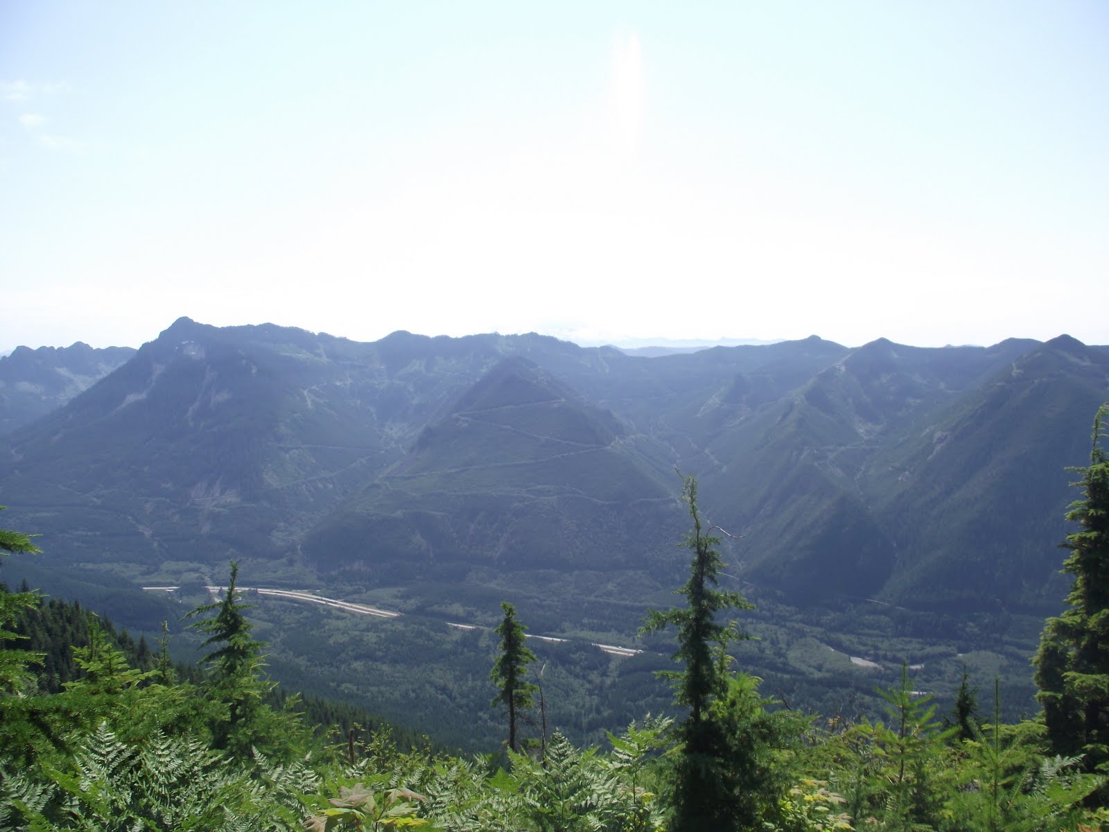
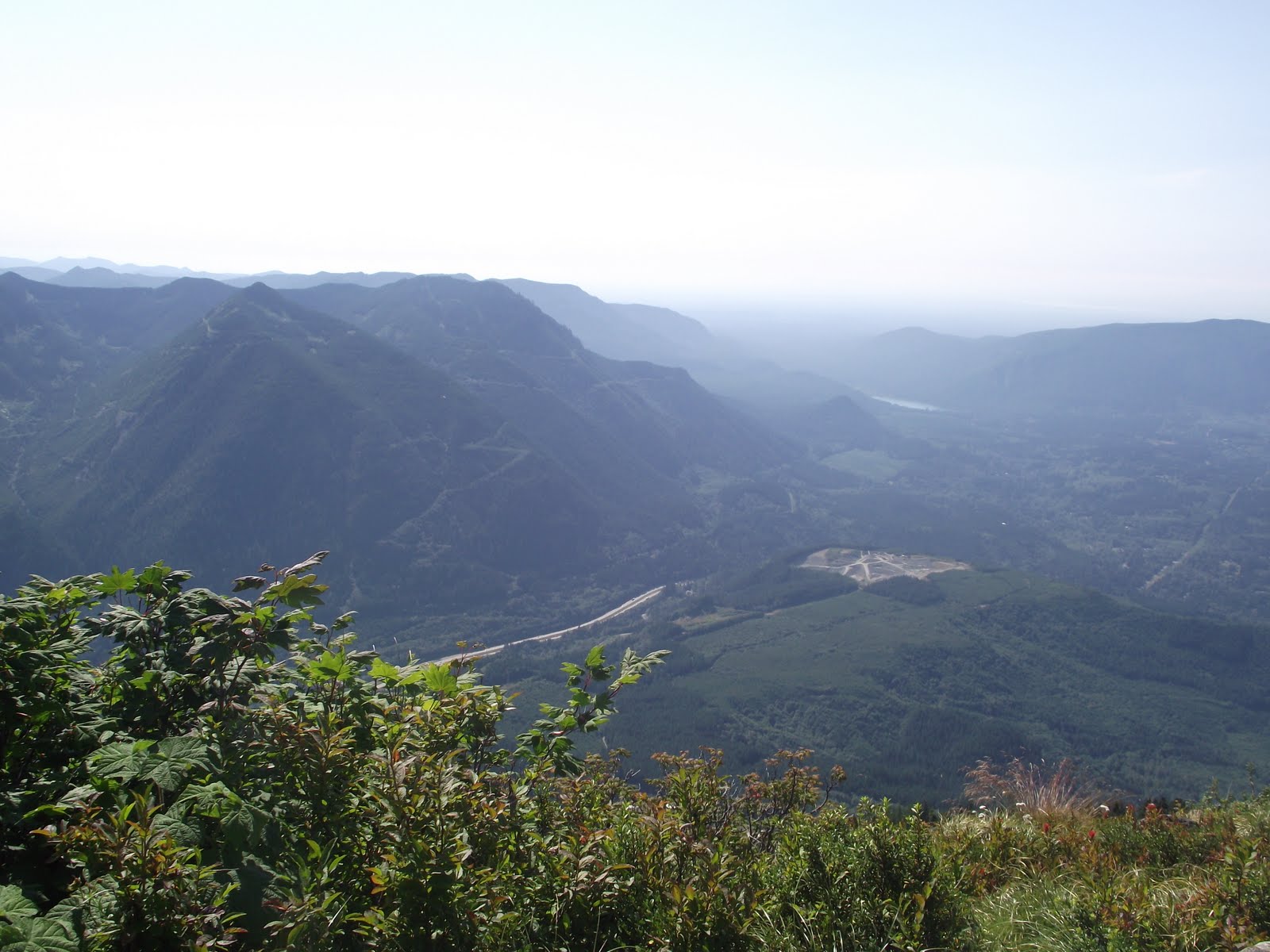
First, I want to show a photo of what it SHOULD have looked like at the top of the summit, if it had been nice weather that day:
Isn't that beautiful???
Now, on to OUR version of the climb... The pictures are in a weird order because we only took one photo at the beginning of our hike in the forest, then saved the rest of the photos for the summit and coming back down. We wanted to make sure we made it all the way up first and take photos on our way back down if we had time.
 |
| Hiked through 2.5 miles of forest like this before getting above the treeline. |
 |
| Me at the summit, being pounded by rain and wind. haha |
 |
| Glad we made it together! |
 |
| We did it! |
 |
| Beautiful view, right? |
 |
| I could hardly look over the edge of this without feeling sick. It was SOOO steep on the other side. |
 |
| Just a tad bit steep on the way down from the summit... |
 |
| That's me |
 |
| Goat territory. On our way up, about 15 minutes from summit, a guy told us there were TONS of goats at the top and they were very curious. That was before the storm hit. They must have gone into hiding by the time we got there (or we couldn't see them because of the fog). However, it smelled heavily of goats and we heard a couple. |
 |
| Have to walk across that meadow over to the other patch of snow. |
 |
| This hardly shows how steep and how far the snow stretched. |
 |
| This was my position almost all the way down the mountain. This explains why my knees feel the way they do. My legs felt like jello by the end. |
 |
| Collin waiting for me down below. |
 |
| We zig-zagged across the snow to these large rocky areas because they were easier to climb around on than trudging all the way down through snow. |
 |
| That's right... we are going DOWN THERE. |
 |
| After awhile, I was tired of the tedious stepping and decided to try out this little sledding area. I'm not posting later photos for a reason. Let's just say sliding down wasn't such a great idea. At one point I couldn't stop, and I shouted at Collin "HERE I COME!!!!!!!" because I knew I'd run into him if he didn't move... he basically stood more firm and let me run into him, almost toppling him over, but he managed to stay standing and stopped me in the mean time. I was soaking wet and freezing at that point. and more than anything, traumatized. |
 |
| My strong suit was being able to climb over big rocks and hoist myself up on rocks that were up to my chin. |
 |
| This was where our first glimpse of snow had been. Who knew there'd be so much snow at the top? |
WE'RE ALIVE. THE END! :)